Destinations
Travel destinations are the stuff of daydreams and memories. Discover the many options available such as adventure travel, city guides and family vacations.
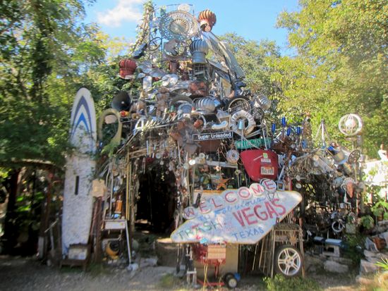
Unveiling the Wonders of the Cathedral of Junk
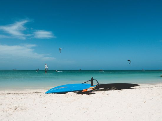
12 Best Beaches in Aruba: A Paradise for Sun Seekers

Best Beaches in Thailand: A Tropical Paradise Awaits

The 9 Best Restaurants in Mountain View, California

10 Alternatives to the Las Vegas Vacation
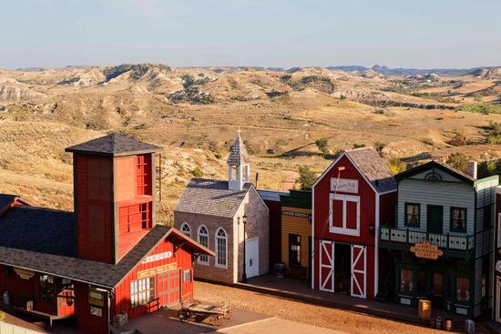
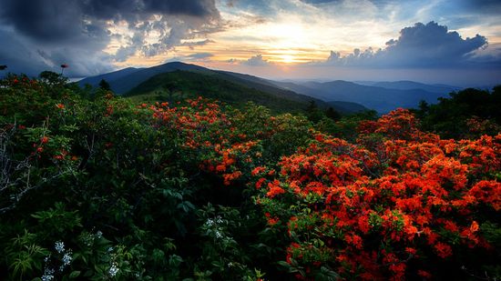
10 Tiny Towns with Big Tourism Dreams
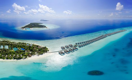
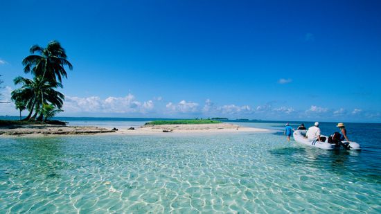
The Complete Guide to Planning Your Perfect Maldives Vacation in 2023
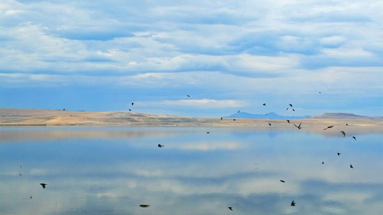
Utah's Fabled Great Salt Lake Is Shrinking
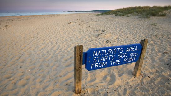
How Nude Beaches Work

California and Marijuana Tourism: What You Need to Know

Family Vacations
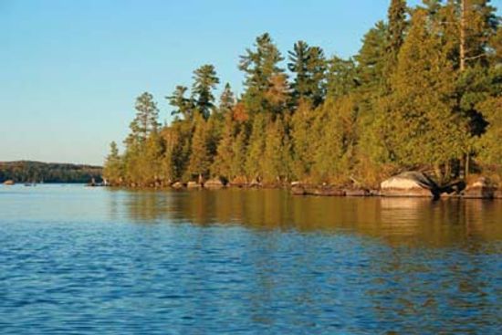
Family Vacations in Minnesota

10 Guaranteed Ways to Ruin a Family Reunion

How to Plan a Family Reunion

Top 10 Family Reunion Games

First Skyscraper: The Birth of Modern Urban Architecture

Steinway Tower: New York's Elegant Addition to the Skyline

CN Tower: Toronto's Skyline Beacon and Architectural Wonder
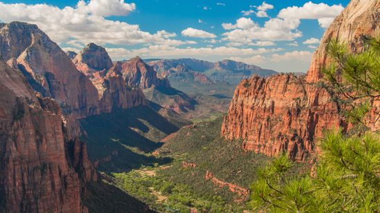
US National Parks by State

Who's Behind the Mysterious Mojave Desert Megaphone?
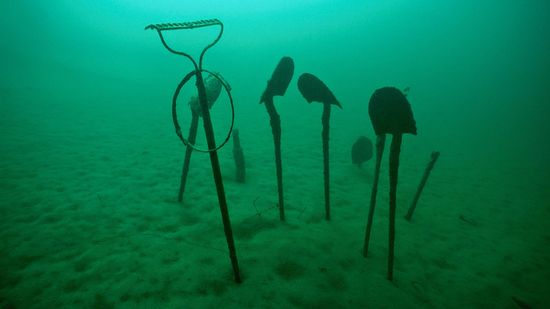
Some of Glacier National Park's Best Sites Are Underwater

Flower-covered Floats Blossom at the Annual Rose Parade

Spain's La Tomatina: The World's Biggest Food Fight

10 Wacky Small Town Festivals
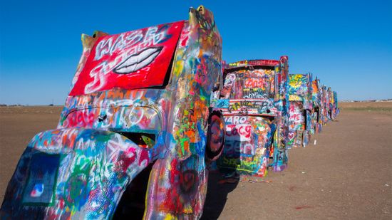
Cadillac Ranch: Where the Cars Are the Canvas

5 Things to Know Before You Try the Driving Experience of a Lifetime
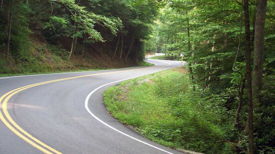
Tail of the Dragon, Plus 4 Other Roads That Are Wicked-fun to Drive
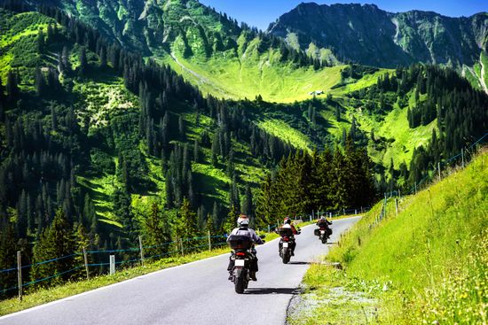
10 Great Motorcycle Trips

10 Foods to Buy by the Side of the Road
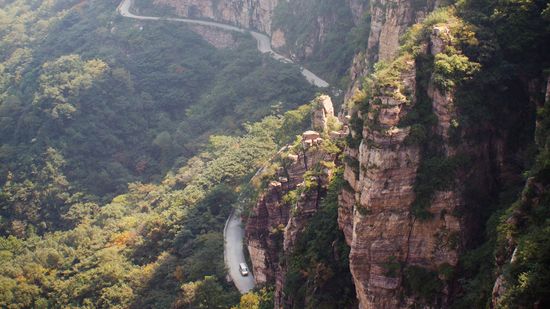
5 Most Dangerous Roads in the World
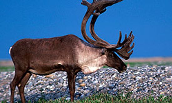
Everything I Need to Know I Learned ... Caribou Tracking
10 Things Alaska and Alabama have in Common

10 Must-haves for a Family-friendly Resort

Could Saudi Arabia's The Rig Be the Next Big Thing in Extreme Tourism?
Disney World and Its Tangled Web With CIA Ops

The Many Haunted Mansions of Disney Theme Parks
Beyond the Appalachian: Meet All 11 of America's National Scenic Trails
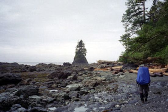
A Guide to Hiking the West Coast Trail
A Guide to Long Trail Hiking

10 RV Travel Tips for Retirees

How to Find a Retiree Travel Club

What are the best vacation spots for baby boomers?
Is Belize Safe to Visit in 2023?

Is Costa Rica Safe? A Comprehensive Guide for Travelers

Is Morocco Safe to Visit in 2023?
Learn More

Discover Austin's Cathedral of Junk, a whimsical masterpiece of recycled treasures and creative genius.
By MapQuest Travel
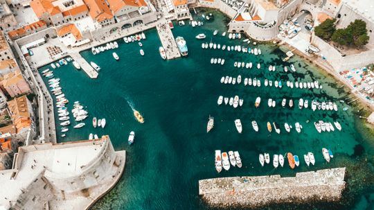
Embark on an unforgettable Yacht Week. Explore exotic destinations, sail in style, and immerse in the world of luxury yachting.
By MapQuest Travel

Explore Kusadasi's sun-kissed beaches, rich history, and vibrant culture on the beautiful Turkish Riviera.
By MapQuest Travel
Advertisement
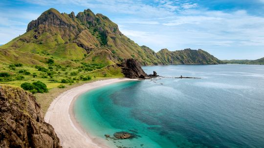
Explore Komodo Island's incredible biodiversity, famous Komodo dragons, and world-class diving spots in Indonesia.
By MapQuest Travel

Delve into Iceland's food scene. Discover traditional dishes, Nordic flavors, and culinary adventures in this vibrant island nation.
By MapQuest Travel
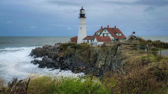
Discover the enchanting world of lighthouses in Maine. Explore their rich maritime history and iconic coastal beauty.
By MapQuest Travel
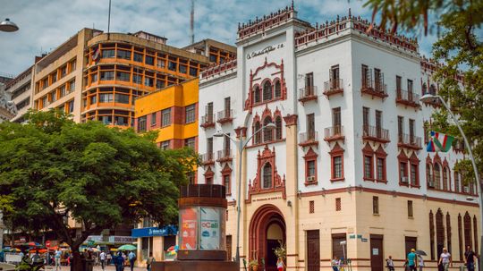
Planning a trip to Colombia? Learn about safety, local tips, and insights to ensure a secure and enjoyable visit.
By MapQuest Travel
Advertisement
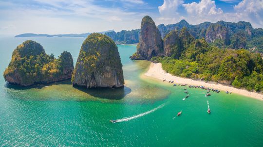
Explore Thailand's stunning beaches. Discover top destinations, crystal-clear waters, and idyllic tropical getaways.
By MapQuest Travel

Uncover the secrets of Rosslyn Chapel. Explore its intricate carvings, rich history, and ties to famous mysteries.
By MapQuest Travel
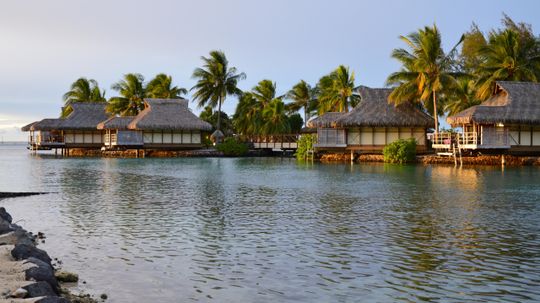
Escape to overwater bungalows in the Caribbean. Experience paradise with crystal-clear waters, vibrant marine life, and serenity.
By MapQuest Travel
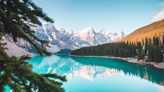
Explore Canada's national parks. Discover diverse ecosystems, iconic wildlife, and endless outdoor adventures.
By MapQuest Travel
Advertisement
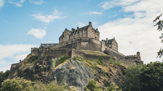
Discover the magic of castles in Scotland. Explore centuries-old history, captivating legends, and stunning architectural treasures.
By MapQuest Travel
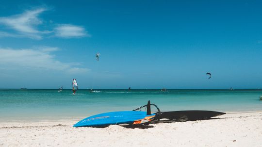
Experience the beauty of Aruba beaches. Discover pristine shores, turquoise seas, and a haven for water sports enthusiasts.
By MapQuest Travel

Discover Sharjah's rich heritage, cultural treasures, and modern developments in this vibrant emirate of the UAE.
By MapQuest Travel
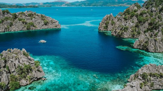
Explore the enchanting beauty of Coron Palawan. Discover its world-class diving sites, pristine landscapes, and tropical wonders.
By MapQuest Travel
Advertisement
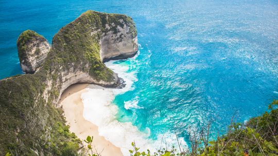
Discover Nusa Penida, Bali's secret paradise. Explore its breathtaking cliffs, vibrant marine life, and hidden natural wonders.
By MapQuest Travel

Explore Santiago de Cuba's rich heritage, lively music scene, and historic sites for an unforgettable Cuban adventure.
By MapQuest Travel
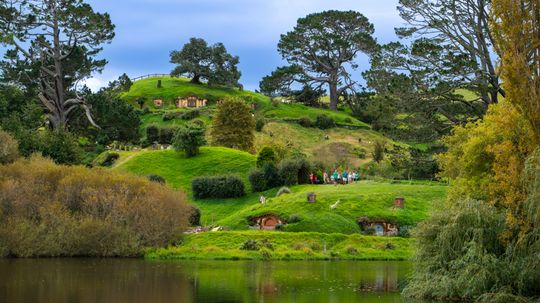
Embark on a magical visit to Hobbiton. Explore the enchanting movie set, lush landscapes, and Hobbiton tours.
By MapQuest Travel

Explore the breathtaking French Alps. Discover world-class skiing, pristine lakes, and charming mountain villages.
By MapQuest Travel
Advertisement
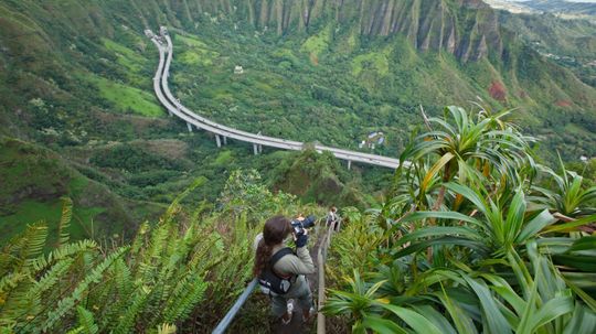
Explore the breathtaking Stairway to Heaven Hawaii hike. Discover its beauty, history, and the stairway's captivating allure.
By MapQuest Travel
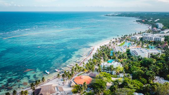
Explore the allure of Mexico beaches. Discover pristine shores, vibrant culture, and diverse coastal gems. Plan your dream beach vacation now.
By MapQuest Travel

Learn what country Dubai is in – a fusion of tradition and modernity in the United Arab Emirates. Discover the magic of Dubai.
By MapQuest Travel
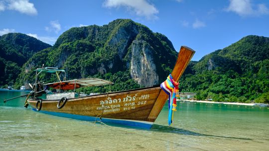
Explore the paradise of Phi Phi Island in Thailand. Pristine beaches, crystal waters, and vibrant marine life await your adventure.
By MapQuest Travel
Advertisement

Discover what a hostel is and its unique travel experience. Learn about budget-friendly accommodations and social interactions.
By MapQuest Travel
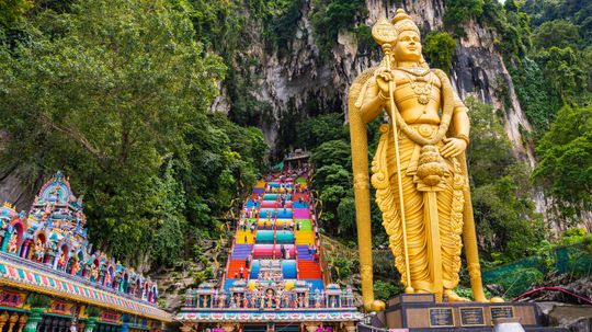
Explore the majesty of Batu Caves in Malaysia. Discover Hindu temples, limestone formations, and vibrant festivities in this iconic site.
By MapQuest Travel