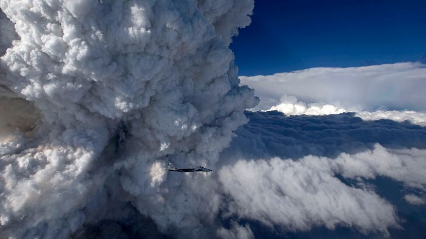
This photograph shows a close-up view of a developing pyrocumulonimbus cloud above the Oregon Gulch fire, part of the Beaver Complex fire, taken from an F-15C on July 31, 2014. James Haseltine, Oregon Air National Guard
There are few things more ominous than a looming thundercloud. Add a wildfire to the mix, and the result can be a towering tempest of thick smoke, smoldering embers and superheated air.
Fire-fueled thunderstorms are naturally occurring weather systems that sometimes spin up as a result of smoke and heat billowing from intense wildfires. These extreme storms, called pyrocumulonimbus (pyroCb), occur infrequently, but when they do, they can lead to tragic results.
Wildfires give off intense heat, forcing large amounts of smoke and hot air to rise. As the mixture moves higher into the troposphere — the lowest layer of Earth's atmosphere — it cools and expands as the air pressure drops. Moisture in the air soon condenses, forming big puffy clouds called pyrocumulus clouds.
When conditions in the atmosphere are just right — including a hot, dry layer of air near the ground and a cooler, wetter layer above it — the atmosphere can become convectively unstable. Increasingly turbulent air sets water droplets and ice crystals in pyrocumulus clouds on a collision course, building up an electrical charge and turning the system into a towering thunderhead.
Advertisement
The soaring pyroCbs, which rarely produce rain on the ground even though they are thunderstorms, can even rise out of the troposphere and extend into the stratosphere 10 of miles/kilometers above the surface.
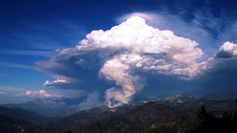
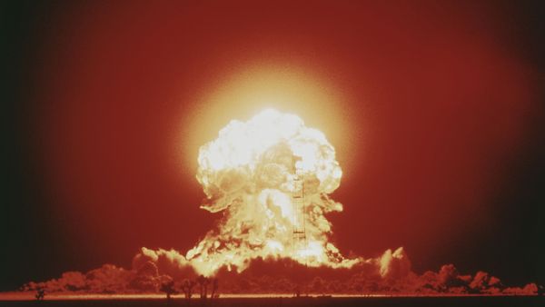
A massive pyrocumulonimbus cloud formed over the Angeles National Forest in 2012 during a fire in Azusa Canyon.
JeremyaGreene/Wikimedia Commons/(CC BY-SA 4.0)
Advertisement
As Dark as Night
Not surprisingly, pyroCbs can be incredibly dangerous. On Feb. 7, 2009, the most devastating day of fires in Australia's history spawned at least three pyroCbs that carried embers 18 miles (30 kilometers) from their source and sparked lightning that ignited additional fires 62 miles (100 kilometers) away. Known as the Black Saturday bushfires, these fires collectively burned 1,737 square miles (4,500 square kilometers) and claimed 173 lives.
A pyroCb that formed during the Carr Fire near Redding, California in 2018 had such strong winds that it created a tornado-strength fire vortex, and a pyroCb in Canberra, Australia, in 2003 was so extreme that it released a torrent of black hail and turned the daytime sky as dark as night.
Advertisement
Fortunately, these events are still relatively rare, although 2019 research from Australia suggests that climate change may cause conditions there to become more favorable for the formation of pyroCbs in the future.
Nick Nauslar, who forecasts fire weather for the National Oceanic and Atmospheric Administration's National Weather Service, said that about 25 to 50 pyroCb events occur around the world each year. He said that predicting exactly when the storms will occur remains a challenge for scientists.
"They are still really difficult to forecast," Nauslar said. Even though scientists can check the weather conditions before a fire, they can't describe exactly how a wildfire will affect the lower atmosphere and change the weather conditions. The effort to study pyroCbs "is still so young and there's still so much to learn," Nauslar said.
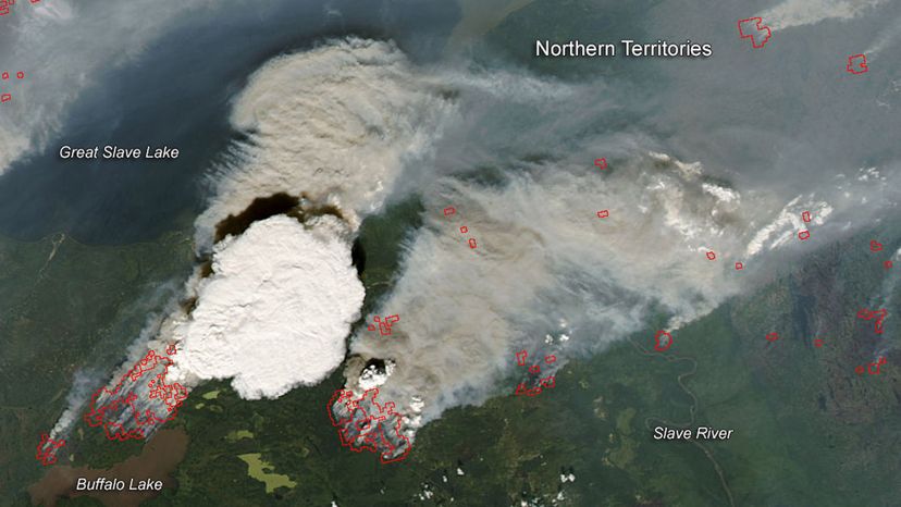
This natural-color image collected by the Moderate Resolution Imaging Spectroradiometer (MODIS) shows a pyrocumulonimbus cloud erupting from a 2014 fire north of Buffalo Lake in Alberta, Canada.
NASA
Advertisement
Smoke High Above
A major signature of pyroCbs is their impact on the stratosphere. But until recently, scientists didn't think wildfires could inject soot, aerosols and organic compounds high into the atmosphere.
The "idea that a firestorm could act like a volcano and inject material into the stratosphere was completely unknown," said Mike Fromm, a meteorologist at the U.S. Naval Research Laboratory in Washington, D.C. Fromm has studied pyroCbs since the late 1990s using satellite instruments.
Advertisement
Smoke particles from pyroCbs can stay in the atmosphere for days to weeks and, in extreme cases, months. Smoke from a massive pyroCb in Canada in 2017 remained suspended in the upper stratosphere for eight months, according to a recent study in the journal Science in which researchers considered the lofted pyroCb particles as a proxy to investigate the potential climatic and atmospheric effects of smoke plumes from nuclear explosions.
PyroCbs won't be causing a nuclear winter anytime soon, but Fromm told Science News that an open question about pyroCb plumes is whether they could damage ozone in the stratosphere. "We're still trying to understand and quantify and calculate [whether] there is, in fact, a climate impact of these plumes," Fromm told Eos.
This story originally appeared on Eos.org and is republished here as part of Covering Climate Now, a global journalism collaboration to strengthen coverage of the climate story.
Now That's Crazy
Pyrocumulus clouds can also form after massive volcanic eruptions. During Kīlauea's unprecedented 2018 eruption, pyrocumulonimbus clouds — complete with lightning strikes — formed over fissure 8 in Leilani Estates on Hawai'i Island.
Advertisement
Cite This!
Please copy/paste the following text to properly cite this HowStuffWorks.com article: