Key Takeaways
- While GPS technology only covers Earth and low-Earth orbit (LEO) due to the direction of satellite signal transmission, space missions rely on earthbound tracking stations and the Doppler effect for navigation.
- NASA's Goddard Space Flight Center created pulsar navigation, a system that uses the predictable timing of neutron stars' pulses as cosmic lighthouses, enabling precise location tracking deep into the solar system.
- The NICER/SEXTANT mission on the International Space Station will test the practicality of pulsar navigation for autonomous interplanetary travel, aiming to avoid the risks of being "lost in space."
DONNER PARTY ARRIVES IN CALIFORNIA, CLAIMING FAIR WEATHER AND SAFE TRAVELS
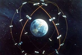
This could have been a headline written in the fall of 1846 if George and Jacob Donner had access to the Global Positioning System, a highly accurate navigational technology relying on signals from an array of satellites orbiting about 12,500 miles (20,200 kilometers) above Earth's surface [source: GPS.gov]. Unfortunately for the Donner brothers and their ill-fated band of pioneers, GPS would require another 100 years of R&D, leaving them to find their way to California using compasses, maps and bad advice. In the end, their long journey turned into a tortuous nightmare. They became snowbound in the Sierra Nevada Mountains, where many in their party died before rescuers could reach them in the spring.
Advertisement
Spacefaring explorers may face similar tragedies ifthey can't find a reliable method to orient themselves as they travel to distant planets and, perhaps, faraway stars. GPS seems like the logical candidate for such endeavors, but the system only works if your travel is limited to Earthly destinations. That's because the 24 satellites that make up the GPS "constellation" transmit their signals toward Earth. If you're located below the satellites and have a receiver capable of detecting the signals, you can reliably determine your location. Cruising along the planet's surface? You're good to go. Flying in low-Earth orbit (LEO)? You're covered. Venture above LEO, however, and your handy GPS receiver will quickly find itself above the satellite constellation and, as a result, no longer be able to record a signal. Put another way: GPS satellites only transmit down, not up.
This doesn't mean missions to destinations beyond Earth have to fly blind. Current navigational techniques use a network of earthbound tracking stations that look up and out into space. When a rocket leaves our planet for Mars, Jupiter or beyond, ground crews beam radio waves from the tracking stations out to the vessel. Those waves bounce off the craft and return to Earth, where instruments measure the time it took the waves to make the journey and the shift in frequency caused by the Doppler effect. Using this information, ground crews can calculate the position of the rocket in space.
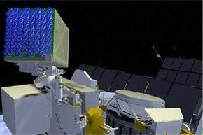
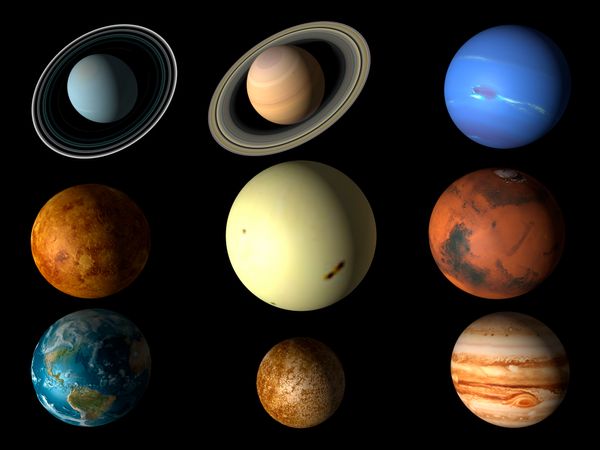
Now imagine you want to travel to the outer reaches of the solar system. When your spacecraft reaches Pluto, you'll be 3,673,500,000 miles (5.9 billion kilometers) away from Earth. A radio signal sent by a tracking station would take 5.5 hours to reach you and then another 5.5 hours to travel back (assuming the waves were traveling at the speed of light), making it more difficult to pinpoint your exact location. Travel even farther, and the accuracy of earthbound tracking systems falls off even more. Clearly, a better solution would be to place a navigational instrument on the spacecraft so it could calculate its position independently. That's where pulsar navigation, an innovation of NASA's Goddard Space Flight Center, comes in.
Advertisement


