How Clouds Work

Clouds in blue sky
Clouds like these are a beautiful and vital part of the planet's weather system. Roman Studio/Moment/Getty Images

Gazing up, you might see a few fluffy bunnies drift by, followed by a fleet of racing sailboats. Finally, the handful of ominous tumbling masses that roll in abruptly ends an afternoon spent gazing at the clouds.

So just where do these clouds come from, and how do they make rain, sleet and snow? Before we get into how clouds work, let's get familiar with all the different types of clouds we see drifting overhead.

Advertisement

­Basically, clouds are differentiated by altitude and by shape. This work was pioneered by Luke Howard at the beginning of the 19th century. From his work, we now classify clouds in a couple of ways. The clearest way to understand this system is to examine the Latin roots of the words.

The main types of clouds are:

  • Cumulus (meaning "heap" or "pile"): flat on the bottom with big billowy tops
  • Stratus (meaning "layer"): short and spread across great distances
  • Cirrus (meaning "curl of hair"): wispy and thin
  • Nimbus (meaning "rain" or "rainy cloud"): likely to bring precipitation

These clouds don't look much like each other, but they all form through the same basic steps. In this article, you'll learn about this process, along with how clouds make rain and why you can see bright blue clouds in some places at twilight.­

Types of Clouds

Cirrus clouds hover high above a solitary oak tree on a ridge in the U.K.
Travelpix Ltd/Photographer's Choice/Getty Images

Whether they look like layers of white frosting or wisps of cotton candy, clouds with similar shapes can form in many regions of the atmosphere. Here's a run-down:

High-level clouds

High-level clouds are typically prefixed by "cirro" and may include cirrus, cirrocumulus and cirrostratus clouds. The latter may cover the sky with a milky blanket, still allowing some weak sunlight and moonlight to filter through. Cirrostratus clouds may be such a thin layer that they're only detectable by the halo they cast around the sun or moon. Cirrocumulus clouds usually create patterns of patchy cotton balls high in the sky. They may also form in bands, creating a wavy appearance. Cirrus clouds appear as white, delicate, wispy stripes or fans that often curve with the wind, which can be useful in determining air patterns. The bottoms of high-level clouds generally begin at altitudes between 6 to 12 kilometers (20,000 - 40,000 feet) above Earth's surface [source: Levine].

Advertisement

Mid-level clouds

Mid-level clouds are usually prefixed by "alto" and include altocumulus and altostratus clouds. Altocumulus clouds either appear as sheets of little round clouds or as parallel stripes of clouds. Though similar to cirrocumulus clouds, altocumulus clouds form at lower altitudes and feature shading on their textured surfaces. Altostratus clouds usually consist of a solid, thick layer of clouds that don't let in enough sunlight to penetrate to the ground to let shadows form. The bottoms of mid-level clouds usually begin around 2 to 6 kilometers (6,500 - 20,000 feet) above the ground [source: Levine].

Low-level clouds

The bottoms of low-level clouds typically reside below altitudes of two kilometers (6,500 feet) and may include cumulus, stratocumulus and stratus clouds [source: ­Tarbuck]. Stratus clouds give the sky an overcast appearance and can resemble fog. Fair-weather cumulus clouds are the large fluffy, clouds often seen on bright blue days, with distinct edges that resemble different shapes. Stratocumulus clouds are low and lumpy, usually with frequent gaps where sunlight or moonlight shines through. These clouds can be diffused over wider distances, resembling regular cumulus cloud with less-defined edges.

Cumulonimbus clouds, like these above French Polynesian waters, may mean rain is on the way.
Jeff Foott/Discovery Channel Images/Getty Images

Vertically-developed clouds

Also called multi-layer clouds, this category can include nimbostratus clouds (dark and low-hanging) and cumulonimbus clouds (large and associated with thunderstorms). Some people consider nimbostratus clouds low-level clouds, but because their height can creep well into in the mid-level range, we've included them in this category.

So now that we have an understanding about the different types of clouds in the skies above us, just how exactly do they get there? Go to the next page to read about where clouds come from. ­

How Clouds Form

Clouds get their moisture from a variety of sources, including evaporated ocean water.
Stephen Studd/Stone/Getty Images

To understand how clouds form, we need to take a step back and examine the processes of evaporation and condensation. Picture a birdbath outside on a hot day. When the temperature of the environment is warm, molecules of water (H2O) are energetic and can move more, expanding the distances between them. More molecules will leave the birdbath's mass of liquid and become water vapor in the air. On a cool day, the molecules have less energy and are less able to separate themselves from the larger mass of water. (On a very cold day, water molecules generally contract into their solid form, ice, and don't have the level of heat energy needed to separate themselves.) You can see the processes occurring in the first two cases. However, the first scenario's result is net evaporation; and the second scenario's result is net condensation. Other factors can affect these outcomes, but for our purposes, we'll just focus on temperature.

As water molecules shift between vapor, liquid and solid phases, they move throughout the air, even if we can't see them. However, when a parcel of air cools quickly and reaches saturation, there's a chance water vapor will condense and appear as a cloud. This could occur because of different factors, like the terrain pushing it upwards into cooler air (called orographic lifting), or perhaps, because it enters a cold front.

Advertisement

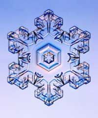
Additionally, cloud formation happens easily when water vapor has something to cling to, allowing the water vapor to change into its liquid or solid phases. A number of particles can act in this function. Commonly called condensation nuclei or freezing nuclei (also known as aerosols or nucleators), the name pretty much says it all if you know about atoms. Typically, things like dust particles, sea salt particles and soot from wildfires will serve as nucleators, and the water droplets or ice crystals form around them. Studies show that bacteria -- specifically certain plant bacteria -- can also serve as the focal point for condensation.

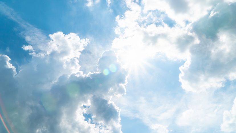
Clouds are, in essence, massive collections of tiny water droplets and crystallized water molecules. The different shapes, textures and other features of clouds depend largely on the conditions under which they form and later develop. For instance, temperature, humidity and altitude are all factors that affect cloud formation.

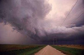
But how do clouds move and eventually disappear? The difference between air within a cloud and the air surrounding it dictates cloud movement. For example, frontal wedging occurs when a cloud that's part of a warmer air mass encounters a colder air mass. The warmer parcel will likely be forced up, over the cold mass. When this happens, rain usually occurs along the front edge of that meeting point.

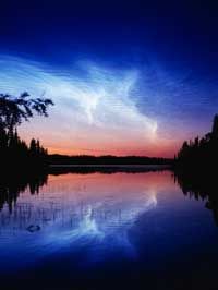
This leads us to how clouds dissipate, or more accurately, evolve. Usually, clouds just change from one type to another. Using the previous example, the front where both masses meet could cause drifting cumulus clouds to change into a line of nimbostratus clouds (delivering precipitation). As the warm air continues to rise, those clouds could evolve into altostratus clouds, then cirrostratus clouds, and finally into cirrus clouds. As the weather pattern progresses, the air mass might reach a point where the clouds dissipate. It's only a matter of time before that water vapor joins another cloud, and the process begins again.

So what do all these different clouds do, and how do they impact us down here on the ground? Continue to the next page to find the answers to these questions.

Clouds and Precipitation

Cumulonimbus clouds often mean severe thunderstorms and other serious weather.
David James/Riser/Getty Images

Clusters of water droplets (called cloud droplets) and crystallized frozen water (called ice crystals or snow crystals) form clouds. A cloud can contain both of these, depending on its temperature. For instance, a cloud's top may be cooler than the lower regions, creating a mix of liquid and frozen water.

Gravity causes all this water to fall as rain. The average size and volume of a cloud droplet is tiny, but, if a cloud droplet manages to attract enough water, the influence of gravity causes it to become a raindrop and fall.

Advertisement

That being said, snow happens a lot like rain. As snow crystals condense and clump together, snowflakes form. When they reach the point where they're too heavy to remain aloft, they fall together as snow. Different surrounding temperatures affect what type of snowflakes will develop. Sometimes on the way down, snowflakes melt into rain; other times they fall intact.

A photograph of a snowflake, taken with a special photomicroscope.
Photo courtesy Kenneth G. Libbrecht and SnowCrystals.com

You may be asking, "If water droplets and snow crystals make up clouds, how do we get hail, sleet and freezing rain?" The answer is that once cloud droplets and ice crystals condense and reach critical falling mass, a few additional processes can occur.

  • Freezing rain, also known as glaze, can occur where warm and cold air fronts meet. A snowflake can fall into cold air, then pass through a layer of warmer air and melt. As it continues to fall and right before it hits, the snowflake passes through a layer of cold air and becomes supercooled. This means that it won't refreeze, but upon impact with a cold object, such as the street or a tree branch, it will immediately turn to ice.
  • Sleet starts the same way as freezing rain, but the melted snowflakes have time to refreeze before they hit the ground.
  • Hail forms during severe storms. The gusty updrafts produced by high winds may knock snowflakes and raindrops up and down until the supercooled water droplets collect themselves into chunks of ice. This can happen repeatedly, until the heavy hail can no longer be lifted by the storm's powerful updrafts. The resulting ice chunks can be quite large when they're finally released and create quite an impact if they hit objects like the hood of your car.

Besides precipitation, do clouds serve any other purpose? Clouds have several other important functions that benefit life on Earth. Read about these benefits on the next page.

The Purpose of Clouds

Although a variety of clouds pass over the Arizona's Painted Desert, little rain falls.
Macduff Everton/The Image Bank/Getty Images

Clouds have many effects on our climate besides simply hurling down hail and covering us in snow. For example, they serve as barriers for heat moving both in and out of the Earth's atmosphere. Researchers estimate that clouds' current net effect on our planet's atmosphere is to cool it slightly. This is, however, something researchers are examining closely, as part of efforts to gather information on possible climate change.

Clouds generally affect the temperature in two ways. Over the surface of the planet, clouds reflect about 20 percent of the incoming heat back into space [source: Tarbuck]. Clouds, water vapor and other atmospheric gasses also absorb about 20 percent of this incoming solar radiation. Low-level clouds reflect the greatest amount of heat, which is why we enjoy cooler temperatures during a cloudy day. Conversely, a cloudy night is warmer than a cloudless night because clouds also create a blanketing effect. Clouds partially absorb outgoing heat (such as the heat released in the evenings, as the ground cools) and reradiate a portion of that heat back towards the Earth's surface. High-level clouds typically absorb this outgoing heat.

Advertisement

Clouds regularly help shift dust, bacteria and other particles throughout the planet's surface. Clouds carry dust at a rate much faster than you might think. One estimate puts the amount of dust moving from Africa to a portion of the Amazon basin in South America at about 13 million tons annually [source: Phillips].

Unfortunately, too much dust in the atmosphere can decrease the amount of rain that falls on a region. This is thought to be due to the fact that when raindrops form by lots of nucleators, these drops grow smaller and are therefore less prone to fall. So if a region has a lot of dust in the air, it likely will receive less rain. This can contribute to desertification (where a local climate slowly changes to desert) and is one of the factors scientists believe is behind the landscape changes around central Africa.

Think we're done? We still haven't talked about some of the most interesting clouds of all, so go to the next page to learn all about them.

Rare Clouds

Noctilucent clouds photographed at Alaska's Kenai National Wildlife Refuge.
Fred Hirschmann/Science Faction/ Getty Images

Beyond the types of cloud already mentioned, there are a few others that offer some interesting, sky-gazing masterpieces.

Rare clouds include lenticular clouds and cap clouds, both examples of orographic lifting, mentioned earlier. Lenticular clouds, featuring layers and a distinctive swirl pattern that makes them resemble anything from spinning tops to pancakes, are formed by the terrain's effect on air movement. Cap clouds, which mask mountaintops, form by a similar process.

Advertisement

Contrail clouds are another interesting type of rare clouds. After jet planes release exhaust streams, these clouds form in the wake of this exhaust. Contrails occur when the upper atmosphere's cold air freezes the vapors in the jet planes' exhaust. These clouds usually fade quickly after the jet passes.

Probably the most fascinating rare cloud is the noctilucent cloud, also known as polar mesospheric clouds (the latter term if you're viewing them from space). The word noctilucent comes from "night" and "shining," and true enough, you can catch a glimpse of these rare clouds only at twilight, when they glow a vibrant blue in our atmosphere's highest reaches.

Perhaps the most intriguing thing about noctilucent clouds is that they may not have always been around. Their first recorded sightings came a few years after the 1883 eruption of Krakatau; and many people believe that the volcano and noctilucent clouds are related. Krakatau's violent explosion sent particles of ash, dust and moisture to incredible heights -- as high as 80 kilometers (262,467 feet) -- and the clouds began to develop.

As Krakatau's wide-reaching effects settled during the five years following the eruption, people assumed that noctilucent clouds would also fade. But these clouds still exist and are spreading. Many people believe Krakatau might have been the trigger, but they claim that other elements allow noctilucent clouds to stay around today.

Possible contributing factors of noctilucent clouds include:

  • Space shuttles: Water vapor expelled in space shuttle exhaust could provide the clouds' moisture (similar to contrail cloud development).
  • Pollution: The Industrial Revolution's pollution could have provided condensation nuclei for the clouds to develop. The effects of global warming actually decrease the temperature in the outer reaches of the atmosphere.
  • Meteoroids: The near-constant influx of tiny particles of meteoroids could also contribute to the cloud formation.

If your head isn't in the clouds and you want to learn more about this topic, visit the cloud-related links floating lazily in the next section.

Lots More Information

Related Articles

More Great Links

  • Britt, Robert Roy. "Weather 101: All About Wind and Rain." Live Science. (4/23/2008) http://www.livescience.com/environment/weather_science.html
  • Davenport, Steve. "Noctilucent Clouds." MeteoGroup. 9/5/2007. (4/23/3008) http://www.meteogroup.co.uk/uk/home/weather/weather_news/ news_archive/archive/2007/may/ch/794bb3c5fa/article/ noctilucent_clouds.html
  • Fraser, Alistair. "Bad Clouds FAQs." Pennsylvania State University. (4/22/2008) http://www.ems.psu.edu/%7Efraser/Bad/BadFAQ/BadCloudsFAQ.html
  • Fraser, Alistair. "Bad Meteorology: The reason clouds form when air cools is because cold air cannot hold as much water vapor as warm air." Pennsylvania State University. (4/22/2008) http://www.ems.psu.edu/%7Efraser/Bad/BadClouds.html
  • Harris, Richard. "Gas Cloud Headed for Milky Way Collision." NPR. 1/11/2008. (4/22/2008) http://www.npr.org/templates/story/story.php?storyId=18027001
  • Joyce, Christopher. "Snow Flurries, Bacteria Likely." NPR. 3/3/2008. (4/22/2008) http://www.npr.org/templates/story/story.php?storyId=87761584
  • Levine, Arlene. "Earth's Mysterious Atmosphere." NASA. 9/30/2002. (4/24/2008) http://asd-www.larc.nasa.gov/edu_act/clouds.html
  • Libbrecht, Kenneth. "A Snowflake Primer." SnowCrystals.com. (4/24/2008) http://www.its.caltech.edu/~atomic/snowcrystals/
  • NASA Cloudsat Publications. "Cloudsat." "The Importance of Understanding Clouds." Jet Propulsion Laboratory at the California Institute of Technology. (4/22/2008) http://cloudsat.atmos.colostate.edu/publications
  • National Weather Service. "Clouds." 8/29/2007. (4/22/2008) http://www.srh.weather.gov/srh/jetstream/synoptic/clouds.htm
  • National Weather Service. "How are clouds named and who named them?" (4/22/2008) http://www.wrh.noaa.gov/fgz/science/clouds.php
  • O'Carroll, Cynthia. "NASA Satellite Captures First View of Night-Shining Clouds." NASA Goddard Space Flight Center. 6/28/2007. (4/24/2008) http://www.nasa.gov/mission_pages/aim/multimedia/first_view.html
  • Palmer, Chad. "Understanding Clouds and Fog." USA Today Weather team. (4/22/2008) http://www.usatoday.com/weather/wcloud0.htm
  • Phillips, Tony. "All the World's a Stage for Dust." NASA Science and Technology Directorate. 6/26/2001. (4/22/2008) http://science.nasa.gov/headlines/y2001/ast26jun_1.htm
  • Phillips, Tony. "Dust Begets Dust." NASA Science and Technology Directorate. 5/22/2001. (4/22/2008) http://science.nasa.gov/headlines/y2001/ast22may_1.htm
  • Phillips, Tony. "Night Clouds." NASA Science and Technology Directorate. 6/20/2003. (4/22/2008) http://science.nasa.gov/headlines/y2003/20jun_TMAclouds.htm
  • Phillips, Tony. "Strange Clouds." NASA Science and Technology Directorate. 2/19/2003. (4/22/2008) http://science.nasa.gov/headlines/y2003/19feb_nlc.htm
  • Plymouth State University Meteorology Program. "Cloud Boutique." (4/25/2008) http://vortex.plymouth.edu/clouds.html/
  • University of Illinois. "Clouds and Precipitation." (4/25/2008) http://ww2010.atmos.uiuc.edu/(Gh)/guides/mtr/cld/home.rxml
  • Schroder, Wilfried. "Were Noctilucent Clouds Caused by the Krakatoa Eruption? A Case Study of Reaserch Problems before 1885." Bulletin of the American Meteorological Society. 4/20/2008. (4/24/2008) http://ams.allenpress.com/archive/1520-0477/80/10/pdf/ i1520-0477-80-10-2081.pdf
  • ­Tarbuck, Edward and Lutgens, Frederick. "Earth Science Eleventh Edition." Pearson Prentice Hall. 2006. (4/28/2008)
  • Williams, Jack. "Molecular motion determines water's state." USA Today. (4/22/2008) http://www.usatoday.com/weather/tg/wevapcon/wevapcon.htm